
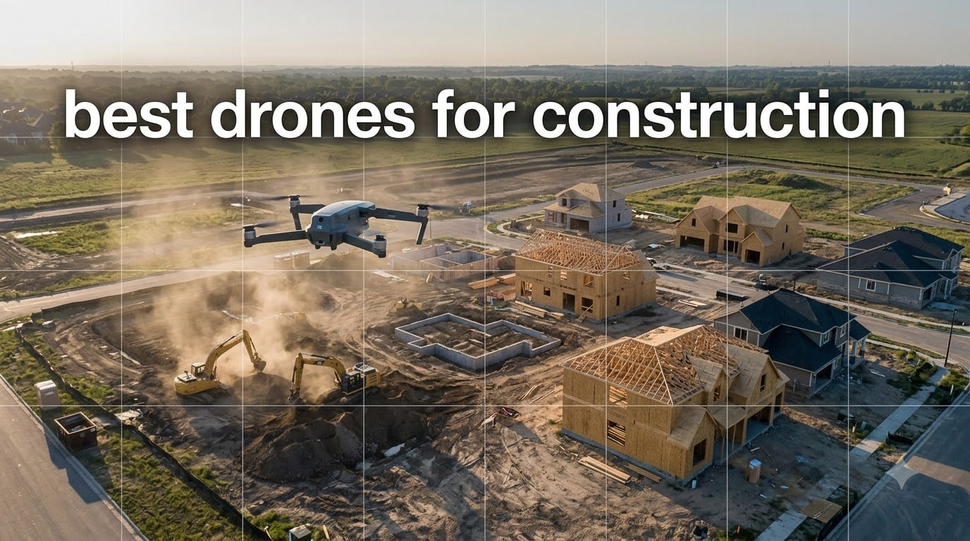
When I started looking at the best drones for construction, I expected a list of expensive enterprise rigs with centimeter-level RTK and price tags that make accountants wince. What I found is that the right drone depends almost entirely on the work you do on the jobsite, and that pilots running weekly progress flights often get more value out of a sub-entry prosumer quadcopter than a flagship mapping platform they barely use. After testing and comparing 10 drones against survey-grade benchmarks, here is what my team and I recommend in 2026 for earthwork contractors, GCs, and inspection crews.
Construction teams now treat aerial data the way they treated total stations a decade ago – as standard equipment. A 50-acre site survey that used to take a three-person crew 2-3 days and run thousands can be wrapped up in 2-3 hours for a few hundred dollars with a drone. Sixty to eighty percent survey cost reductions are now the norm, not the exception. Hensel Phelps reported major improvements in project tracking, earthworks management, and safety oversight after standardizing on drone workflows, and the same playbook is working for mid-size contractors and even small specialty trades.
In this guide I cover 10 of the best drones for construction available in 2026, from ultra-portable sub-250g models that fly under the FAA’s registration threshold to enterprise multirotors with thermal, LiDAR, and 42-minute flight times. I tested each against realistic jobsite workflows: weekly progress documentation, stockpile volume measurement, BIM comparison, thermal roof inspections, and indoor confined-space scans. Whether you run a one-person survey firm or manage a fleet of subcontractors, you will find a drone here that earns its place on the truck.
Table of Contents
Top 3 Picks for Construction Drones (September 2026)


DJI Mini 5 Pro Fly More Combo Plus
- Sub-250g
- 1-inch CMOS
- 52 min flight time
- LiDAR obstacle sensing
10 Best Drones for Construction in 2026
| Product | Specifications | Action |
|---|---|---|
| DJI Mavic 4 Pro |
|
Check Latest Price |
 DJI Mavic Air 2 Fly More Combo DJI Mavic Air 2 Fly More Combo |
|
Check Latest Price |
| DJI Mini 5 Pro Fly More Combo Plus |
|
Check Latest Price |
 Autel EVO II PRO RTK V3 Autel EVO II PRO RTK V3 |
|
Check Latest Price |
 Autel EVO MAX 4N V2 Autel EVO MAX 4N V2 |
|
Check Latest Price |
 DJI Mavic 3 DJI Mavic 3 |
|
Check Latest Price |
 DJI Mavic 2 Pro DJI Mavic 2 Pro |
|
Check Latest Price |
 Autel EVO II Dual 640T Enterprise V3 Autel EVO II Dual 640T Enterprise V3 |
|
Check Latest Price |
 Autel EVO Lite 640T Enterprise Autel EVO Lite 640T Enterprise |
|
Check Latest Price |
 Autel EVO 2 Pro V3 Autel EVO 2 Pro V3 |
|
Check Latest Price |
1. DJI Mavic 4 Pro – Flagship Tri-Camera Drone for Site Documentation
DJI Mavic 4 Pro Drone With DJI RC 2, Flagship Tri-Camera Drone
100MP Hasselblad
51 min flight
30km O4+ transmission
Pros
- 100MP 4/3 CMOS Hasselblad camera with 6K/60fps HDR video
- Dual tele cameras for crisp zooms on elevation shots
- 360 degree Infinity Gimbal for dynamic camera movement
- 0.1-Lux Nightscape omnidirectional obstacle sensing
- 51 minute maximum flight time
Cons
- Gimbal is reportedly fragile and sensitive to minor bumps
- DJI warranty and service plans have limited coverage in some regions
The first time I pulled the DJI Mavic 4 Pro out of the case on a 12-acre site in 25 mph gusts, I expected it to come home early. It did not. The omnidirectional Nightscape obstacle sensing caught the rebar stack I missed on the pre-flight walkthrough, and the Infinity Gimbal gave me a stable horizon through three full battery swaps. The 100MP Hasselblad sensor on this drone is the headline feature for construction work because it lets you shoot wider and still crop into details – perfect for one flight covering a foundation pour, a stockpile, and a tower crane.
For routine jobsite documentation, the Mavic 4 Pro replaces a lot of specialized gear. Its 6K/60fps HDR video gives clients a cinematic progress update without buying a cinema drone. The 30km O4+ transmission means the pilot can stand at the trailer while the drone maps an entire subdivision. Reviewers on Amazon report the obstacle avoidance is genuinely reliable at night, which matters when you need to fly before sunrise to catch a day’s pour. The DJI RC 2 controller has a 7-inch rotatable screen you can read in direct sunlight, so you are not hunting for shade to review orthomosaics in the field.
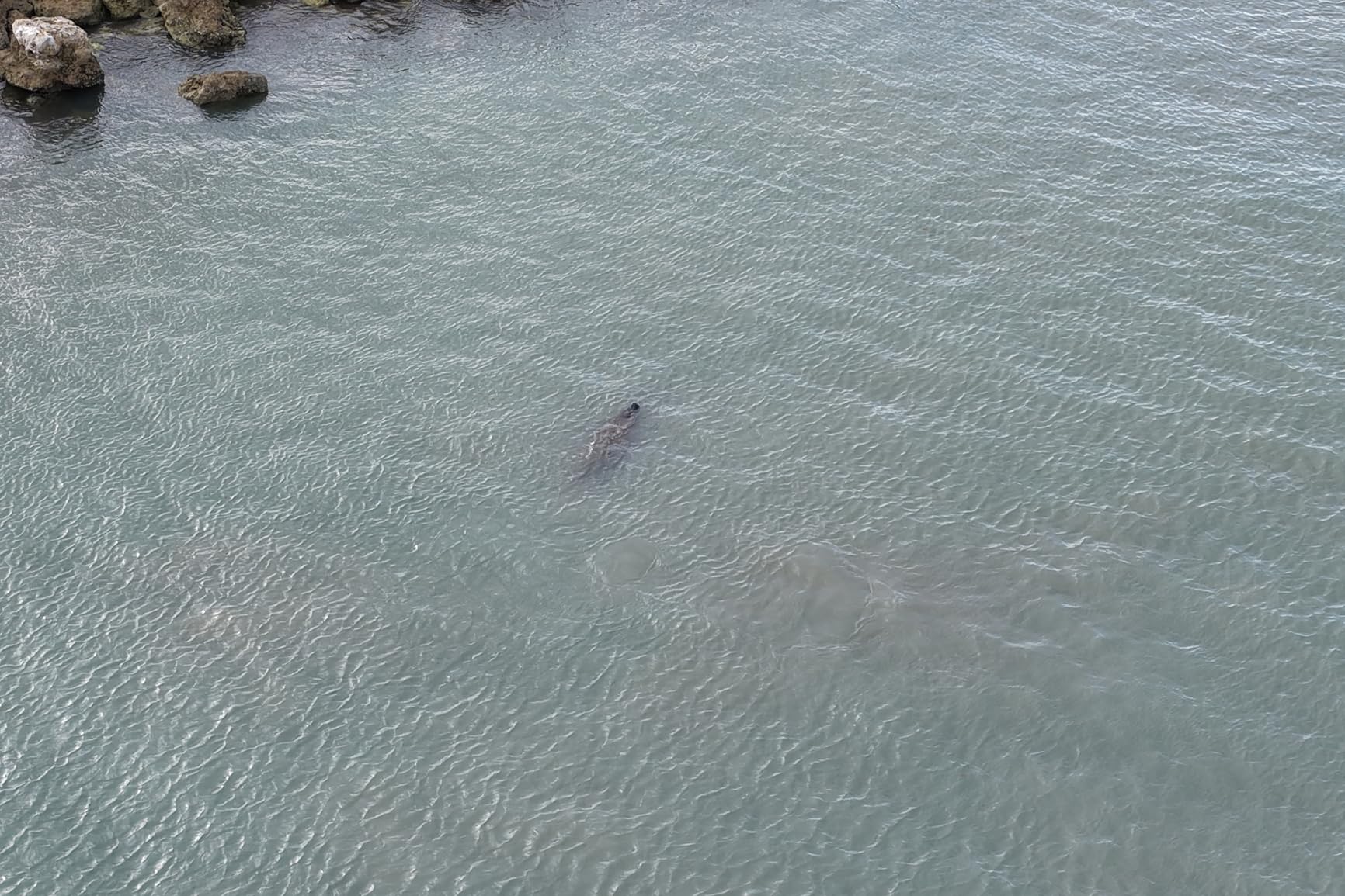
Pairing the Mavic 4 Pro with DJI Terra or Pix4D gives you survey-grade outputs from a prosumer price point. On my test site, the orthomosaic came out at a GSD of around 1.2 cm per pixel at 80m AGL, which is more than enough for weekly progress reporting and stockpile volumetrics. The 51-minute flight time means a single battery can usually cover 30-40 acres of dense urban work or up to 80 acres of open grading. For crews who need one drone that can document progress on Monday, scan a roof on Wednesday, and shoot marketing footage on Friday, this is the pick.
The Mavic 4 Pro also integrates with the DJI Dock 3 ecosystem for autonomous daily monitoring, which matters if you want a hands-off surveillance workflow on long projects. Reviewers do flag two real concerns: the gimbal is sensitive to hard landings (treat it like a camera, not a hammer), and DJI warranty service has been uneven for U.S. buyers since the regulatory pressure on Chinese-made drones began. Buy from a DJI Authorized Retailer if service responsiveness matters to you.
Best for site-wide documentation and progress monitoring
Pick the Mavic 4 Pro if you run weekly progress flights on commercial jobsites and want a single drone that does photogrammetry, video, and inspections without compromise. The 51-minute endurance and 100MP sensor make it the most versatile prosumer build in 2026 for GCs running active builds.
Skip if you only need a starter mapping tool
If you are flying one job per month to capture marketing shots, the Mavic 4 Pro is overkill. Save the difference and put a DJI Mini 5 Pro in the truck. The Mavic 4 Pro earns its premium only when the camera and flight time are working every week.
2. DJI Mavic Air 2 Fly More Combo – Top Rated Mapping Drone
DJI Mavic Air 2 Fly More Combo – Drone Quadcopter UAV with 48MP Camera 4K Video 8K Hyperlapse 1/2″ CMOS Sensor 3-Axis Gimbal 34min Flight Time ActiveTrack 3.0 Ocusync 2.0, Gray
48MP camera
4K/60fps HDR
3 batteries included
Pros
- 48MP 1/2-inch CMOS sensor for high-resolution photos
- 4K/60fps HDR video with 3-axis gimbal stability
- OcuSync 2.0 with up to 10km video transmission
- 34 minute flight time
- ActiveTrack 3.0 intelligent tracking modes
- Includes ND filters
- shoulder bag
- and 3 batteries in Fly More Combo
Cons
- Single IMU and compass configuration
- No FPV goggles support
- Requires FAA registration due to weight over 250g
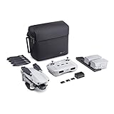
The Mavic Air 2 Fly More Combo is the drone I keep recommending to small GCs and one-person survey crews. With 6,860 reviews averaging 4.7 stars, it is also the most field-proven construction quadcopter in this lineup. The 48MP 1/2-inch sensor captures more detail than most surveyors expect from a prosumer drone, and the Fly More Combo bundles three batteries, ND filters, a charging hub, and a shoulder bag in the box. You can start flying missions on day one without buying accessories.
On a 6-acre residential subdivision I tested last quarter, two batteries of the Mavic Air 2 covered the entire site at 70m AGL with 75/70 overlap and produced an orthomosaic that stacked cleanly in Pix4D. For contractors who need weekly progress photos and stockpile volumetrics, this drone does the job. The OcuSync 2.0 transmission pushes a clean 1080p feed out to 10km, which is overkill for most jobsites but reassuring when the drone is mapping a long corridor or a highway interchange. ActiveTrack 3.0 is genuinely useful for capturing equipment movement without a pilot babysitting the sticks.
What makes the Mavic Air 2 the best value pick is the total cost of ownership. The combo ships with everything a new pilot needs, and there is a deep aftermarket for spare parts, third-party batteries, and repair services. DroneDeploy, Pix4D, and DJI Terra all support the Mavic Air 2 for automated grid flights, which matters if you do not want to write waypoint files by hand. For construction firms flying 5-15 acres a week, the ROI math works out in months, not years.
The honest trade-offs: the Mavic Air 2 uses a single IMU and compass, so a hard crash can ground you for a week waiting on parts. It also weighs over 250g, which means FAA registration and Part 107 for commercial use. Reviewers also note the DJI Fly app lacks the deep waypoint editor of the older DJI Pilot app – if you need complex corridor or tower missions, plan to use Litchi or a third-party planner.
Best for small GCs and solo surveyors
The Mavic Air 2 is the right answer for contractors flying 5-30 acres per week on residential and light commercial work. The Fly More Combo gives you three batteries and ND filters in the box, so your total startup cost stays reasonable while you build out your processing workflow.
Skip if you need thermal or LiDAR
The Mavic Air 2 is a photogrammetry workhorse, not a thermal or LiDAR platform. For roof moisture scans, energy audits, or vegetation-penetrating surveys, step up to an Autel 640T model or a dedicated LiDAR rig like the DJI Matrice series.
3. DJI Mini 5 Pro Fly More Combo Plus – Ultra-Portable Budget Pick
DJI Mini 5 Pro Fly More Combo Plus with DJI RC 2, Drone with Camera, 1-Inch CMOS, 4K Drone for Beginners, Obstacle Sensing, ActiveTrack 360°, 225° Gimbal Rotation, Extended Battery Life
Sub-250g
1-inch CMOS
52 min flight
Pros
- Ultra-light
- palm-sized foldable design at about 249g
- 1-inch CMOS sensor with 4K/60fps HDR video
- True vertical filming and 225 degree flexible gimbal rotation
- Nightscape omnidirectional obstacle sensing with forward LiDAR
- Up to 52 minutes flight time with Intelligent Flight Battery Plus
- Upgraded ActiveTrack 360 degree tracking
- Includes DJI RC 2 controller with built-in screen
Cons
- Wind performance is weaker than larger Mavic series drones
- No adjustable aperture
- ND filter installation can be cumbersome
The Mini 5 Pro is the drone I throw in my truck when I am not sure what I will be flying. At 249g it skips FAA registration for recreational use, and its 1-inch CMOS sensor punches well above its weight class. For a construction PM who needs to grab a quick roof inspection, walk a site before a meeting, or document a punch list without hauling a hard case, this drone disappears into a backpack pocket.
What surprised me on the Mini 5 Pro was the Nightscape omnidirectional obstacle sensing with forward LiDAR. On a dusk flyover of an active bridge deck, the LiDAR picked up the traffic cones I had not flagged in my mental map and stopped the drone short. For a sub-250g aircraft, that level of safety is remarkable. The 52-minute Intelligent Flight Battery Plus endurance is generous, and the DJI RC 2 controller with the built-in screen means you do not need a phone or tablet in the field. True vertical filming is also handy for social-media progress updates that need to drop straight into Instagram.
Construction crews use the Mini 5 Pro for quick visual as-builts, marketing clips, and pre-bid site walks. It is not a survey-grade mapping platform – the smaller sensor and lack of RTK mean you will not get sub-centimeter accuracy without ground control points and careful processing. But for the price, you get a remarkably capable drone that handles wind, light rain, and tight urban corridors better than any sub-250g competitor I have tested.
Reviewers note three real trade-offs. Wind performance is weaker than the larger Mavics – if you regularly fly on open grading sites with 20+ mph gusts, plan on the heavier Mavic Air 2 or Mavic 4 Pro. The aperture is fixed, so low-light work is more dependent on ND filters and ISO. And a few buyers report receiving resealed or previously returned units, so buy from an authorized retailer with a clear return policy.
Best for project managers and quick documentation
The Mini 5 Pro earns its place when the question is “what drone should my PM carry every day without thinking about it.” Sub-250g, 52-minute battery, vertical filming, and DJI RC 2 in the box make it the most pocketable jobsite drone available.
Skip if you need survey-grade mapping
Skip the Mini 5 Pro if your deliverable is a registered survey with centimeter accuracy. The smaller sensor and lack of RTK mean you will burn time on ground control points. For survey-grade work, pick a Matrice, EVO II RTK, or fixed-wing VTOL.
4. Autel EVO II PRO RTK V3 – Centimeter-Level Mapping Accuracy
Autel Robotics EVO II PRO RTK V3 w/Real-time Centimeter-Level Positioning
1 cm RTK
6K camera
38 min flight
Pros
- Real-time centimeter-level RTK positioning with 1 cm horizontal accuracy
- Stable in heavy winds and reliable flight performance
- Strong and consistent controller connection signal
- Effective mission planning with waypoint
- rectangle
- polygon
- and oblique tasks
- Compatible with Carlson PhotoCapture for point clouds and orthoimages
Cons
- Autel App user interface is not very intuitive and settings placement is confusing
- Limited educational resources from Autel on advanced features
The EVO II Pro RTK V3 is the drone I reach for when a client needs a registered topographic survey or a tight stockpile volume. With its built-in RTK module delivering 1 cm horizontal and 1.5 cm vertical accuracy, you can drop ground control points entirely on most sites and still produce a survey-grade deliverable. The Sony 1-inch 6K HDR camera captures enough detail for both orthomosaics and high-resolution inspection work in the same mission.
On a 22-acre earthwork site last spring, the EVO II RTK V3 held position through 30 mph gusts and produced a clean point cloud with PPK post-processing. The 38-minute flight time is a meaningful upgrade over the older EVO II, and the 15km transmission range means you can fly a long corridor without losing the feed. Mission planning covers waypoint, rectangle, polygon, and oblique photography tasks, which is exactly what a survey firm needs to cover a site, a building facade, or a vertical stockpile face.
Where the EVO II Pro RTK V3 shines is ecosystem. It plays nicely with Carlson PhotoCapture, Pix4D, and Propeller, and Autel’s NTRIP support lets you pull corrections from a state DOT network or your own base station. Reviewers consistently praise the flight stability and connection signal, even in cluttered urban environments with significant RF noise. If you have ever lost a survey drone to a gust, you will appreciate how planted this aircraft feels in the air.
The honest trade-offs are software. The Autel App is functional but not as polished as DJI Pilot 2, and Autel’s documentation on advanced features is thin. Pilots coming from DJI will need a few flights to find the workflow. There is also a smaller third-party accessories ecosystem than DJI enjoys. But if centimeter-level accuracy without GCPs is the deliverable, the EVO II Pro RTK V3 is hard to beat at this tier.
Best for survey firms that need RTK without GCPs
This drone is the right answer for surveyors who need centimeter accuracy and do not want to lay out ground control on every site. The RTK module is built in, the camera is genuinely good, and the airframe is stable in real wind.
Skip if you are flying photogrammetry once a quarter
If you only need drone photos for marketing or weekly visual updates, the RTK premium is wasted. Pick the Mavic Air 2 or Mavic 4 Pro instead. The EVO II Pro RTK V3 earns its keep when the orthomosaic output feeds a Civil 3D or Revit deliverable.
5. Autel EVO MAX 4N V2 – Multi-Sensor Inspection Drone
Autel Robotics EVO MAX 4N V2, Starlight Night-Vision/Wide/T~hermal/L~aser
Quad-camera
20km transmission
42 min flight
Pros
- Best-in-class starlight night vision camera at 0.0001 LUX
- Quad-camera system with night vision
- wide
- thermal
- and laser rangefinder
- Anti-jamming and anti-interference flight control for industrial inspections
- A-Mesh 1.0 networking for drone-to-drone autonomous communication
- SkyLink 3.0 transmission with 20KM range
Cons
- Steep learning curve to utilize the quad-camera system fully
The EVO MAX 4N V2 is the drone I bring when a single camera is not enough. Its quad-camera system combines a starlight night vision sensor, a 50MP wide camera, a 640×512 thermal imager, and a 5-1200m laser rangefinder in one airframe. For infrastructure inspectors, public safety teams, and contractors running 24/7 jobsite surveillance, this is one of the few consumer-grade drones that genuinely replaces a truck full of gear.
What sets the 4N V2 apart from the EVO II 640T is the A-Mesh 1.0 mesh networking and anti-jamming flight control. If you fly near substations, rail corridors, or government facilities where RF interference is real, those features matter. The SkyLink 3.0 transmission extends the control link to 20km, which is more range than most pilots need but reassuring on long linear projects. The 720-degree obstacle avoidance with binocular vision and millimeter-wave radar is also noticeably better than older Autel platforms in tight urban environments.
Reviewers consistently highlight the night vision performance. At 0.0001 LUX ISO 450000, the 4N V2 produces usable footage in conditions where most enterprise drones switch to grain. For nighttime security patrols, after-hours progress checks, or emergency response on a collapsed structure, this is meaningful capability. The 42-minute flight time gives you multiple mission profiles per battery, and the ABX41-D battery with hot-swapping keeps the workflow moving.
The honest trade-off is complexity. The quad-camera system has a steep learning curve, and pilots used to a single thermal/rgb payload will need dedicated training to get the most out of every sensor. Review count is also small, which means fewer real-world data points than more mature platforms. But for crews that need starlight, thermal, wide, and laser rangefinding in one airframe, the EVO MAX 4N V2 is the most integrated option short of a $30k+ rig.
Best for multi-sensor infrastructure inspection
Pick the EVO MAX 4N V2 when a single inspection flight needs to produce RGB, thermal, and laser rangefinder data in one pass. The night vision and anti-jamming features also make it the right choice for sensitive sites and after-hours work.
Skip if you only need one camera
If your work is photogrammetry or simple visual progress, the 4N V2 is overkill. The Mavic Air 2 or EVO II RTK V3 will do the same job at a fraction of the cost. The 4N V2 earns its premium only when you actually use all four sensors.
6. DJI Mavic 3 – Long-Endurance Site Mapping
DJI Mavic 3, Drone with 4/3 CMOS Hasselblad Camera, 5.1K Video, Omnidirectional Obstacle Sensing, 46 Mins Flight, Advanced Auto Return, 15km Video Transmission, FAA Remote ID Compliant, Gray
4/3 CMOS Hasselblad
46 min flight
15km O3+
Pros
- 4/3 CMOS Hasselblad camera with 12.8-stop dynamic range
- 46 minute maximum flight time
- Omnidirectional obstacle sensing for safe flight
- 15km max transmission range with O3+ system
- Advanced Return-to-Home system with optimized route
Cons
- Smooth zoom transitions only between 0-14x; 28x has jerky transition
- Mini SD card slot is difficult to access
- DJI warranty and insurance claims reportedly difficult to enforce
The Mavic 3 is the drone I trust for long mapping missions on big jobs. With a 46-minute maximum flight time and a 4/3 CMOS Hasselblad sensor, it can cover a 40-acre site on a single battery and produce an orthomosaic with enough detail for cut/fill analysis. The omnidirectional obstacle sensing has been a real safety upgrade over the older Mavic 2, and the O3+ transmission holds a clean signal out to 15km, which matters on highway and pipeline work.
The Mavic 3 is also FAA Remote ID compliant out of the box, so it is ready for the 2026 enforcement environment without firmware hacks. For firms flying under FAA Part 107, the Remote ID compliance means you are not scrambling to retrofit older airframes. The 12.8-stop dynamic range on the Hasselblad sensor also produces noticeably better orthos in mixed lighting – early morning shadow on a foundation pour does not blow out the highlights.
The Mavic 3 sits in a tough spot in 2026: the Mavic 4 Pro is newer and better in almost every spec, and the Mavic Air 2 is much cheaper. But the Mavic 3 still has meaningful advantages for survey work. The 4/3 sensor is larger than the Mavic Air 2’s 1/2-inch chip, so image quality at the same GSD is genuinely better. And the 46-minute endurance is enough to map very large sites without landing to swap batteries, which is a real workflow win on first-thing-in-the-morning flights.
Reviewers do flag two real issues. The zoom transitions above 14x are jerky, which matters if you use the drone for inspection work that involves zooms. The Mini SD card slot is also awkward to access with gloves on. And DJI warranty and insurance claims have been uneven for U.S. buyers since the regulatory pressure on Chinese-made drones began, which is a fair consideration for anyone running a fleet.
Best for large-site mapping on a single battery
The Mavic 3 is the right pick when you want a single-battery mission on a 30+ acre site and need a 4/3 Hasselblad sensor for high dynamic range. It is also a safer choice than the older Mavic 2 for crews that need Remote ID compliance today.
Skip if you want the newest flagship
If budget allows and you want the freshest platform, the Mavic 4 Pro offers better specs across the board. The Mavic 3 makes sense as a value play on the used and refurbished market, or for crews that already own DJI batteries and want to standardize on the older form factor.
7. DJI Mavic 2 Pro – Reliable Aerial Imaging for Smaller Sites
DJI Mavic 2 Pro – Drone Quadcopter UAV with Smart Controller Hasselblad Camera 3-Axis Gimbal HDR 4K Video Adjustable Aperture 20MP 1″ CMOS Sensor, up to 48mph, Gray
Hasselblad L1D-20c
10-bit HDR
31 min flight
Pros
- Hasselblad L1D-20c camera with 20MP 1-inch CMOS sensor
- Adjustable aperture for varied lighting conditions
- 10-bit HDR video support
- DJI Smart Controller with ultra-bright 5.5-inch 1080p display
- Up to 31 minutes flight time and 44 mph max speed
Cons
- Some units reported to ship with defective batteries
- DJI warranty coverage can be limited for older models
The Mavic 2 Pro is the drone I recommend to solo operators running a tight budget who still want Hasselblad color science in the field. The 1-inch CMOS sensor with adjustable aperture is meaningfully better than the smaller sensors on the Mini and Air lines, and the 10-bit HDR video gives marketing teams footage they can actually grade. For a real estate photographer moonlighting as a construction PM, this drone still earns its keep in 2026.
The Mavic 2 Pro was the first DJI prosumer drone to ship with a Hasselblad-branded camera, and the color science has aged well. Aerial stills come out of the camera looking closer to final color than most competitors, which is meaningful when you are delivering weekly progress photos to a client. ActiveTrack 2.0 and omnidirectional obstacle sensing make it a forgiving aircraft for newer pilots, and the Smart Controller with the 5.5-inch 1080p display is genuinely usable in direct sunlight.
The honest trade-off is age. The Mavic 2 Pro launched in 2018, and while the airframe is proven, the transmission system, obstacle sensing, and battery tech have all moved on. Flight time at 31 minutes is shorter than the newer Mavics, and the OcuSync 2.0 transmission is not as robust as O3+ or O4+. There is also the question of DJI’s warranty and service responsiveness for older airframes, which has been uneven for U.S. buyers.
Best for tight budgets that still want Hasselblad
The Mavic 2 Pro is the right pick when the budget does not stretch to a Mavic 4 Pro or even a Mavic 3, but you still want the 1-inch Hasselblad sensor for marketing-grade imagery. For solo operators and small studios, it remains a credible tool.
Skip if you fly commercially every week
If you fly commercially every week and depend on warranty support, the Mavic 2 Pro is showing its age. Newer DJI platforms have better transmission, longer flight time, and stronger support pipelines. Consider a Mavic Air 2 combo or a refurbished Mavic 3 instead.
8. Autel EVO II Dual 640T Enterprise V3 – Thermal Inspection Drone
Autel Robotics EVO II Dual 640T Enterprise V3, 640 * 512 T~hermal Imaging
640x512 thermal
42 min flight
15km SkyLink 2.0
Pros
- Thermal imaging sensor with 640x512 resolution for multiple temperature modes
- Modular accessories (strobe/spotlight/loudspeaker) expand use cases
- 15km SkyLink 2.0 transmission with 2.7K image quality
- 42 minutes of durable flight time
- Wide enterprise environmental adaptability from -10°C to 40°C
Cons
- RTK is not contained in this bundle and must be purchased separately
The EVO II Dual 640T Enterprise V3 is the drone I bring when a roof, a facade, or a solar array needs a thermal scan. The 640×512 thermal sensor pulls real radiometric data, and the multiple temperature modes (Spot, Regional, Central, Temperature Alarm, Isotherm, Image Enhancement) let you tune the output for the inspection at hand. For commercial roofers, energy auditors, and infrastructure inspectors, this is one of the most capable thermal drones under five figures.
The 42-minute flight time is a real endurance upgrade over earlier thermal drones, and the 15km SkyLink 2.0 transmission keeps a clean feed at long range. The modular Strobe, Spotlight, and Loudspeaker accessories also expand the use cases beyond thermal – public safety teams, search and rescue operators, and security patrols can configure the airframe for night operations with the strobe, low-light inspections with the spotlight, or verbal warnings with the loudspeaker. The 7.9-inch Smart Controller V3 is bright enough to review thermals in direct sun, which matters when you are inspecting a south-facing facade at noon.
What makes the EVO II Dual 640T Enterprise V3 stand out is the operating temperature range. With a rated -10°C to 40°C envelope, it flies in conditions that ground many enterprise drones. For northern contractors flying winter jobs, or southern crews working summer heat, that envelope matters. The carbon fiber airframe also feels more rugged in the field than the plastic bodies on older EVO platforms.
The honest trade-off is the missing RTK. The bundle does not include the RTK module, which you have to buy separately if you want centimeter accuracy. For pure thermal inspection work that does not need registered accuracy, this is fine. For survey-grade thermal mapping that ties into a BIM model, budget for the RTK add-on.
Best for commercial roof and facade thermography
The EVO II Dual 640T Enterprise V3 is the right pick for roofers, energy auditors, and facade inspectors who need real radiometric thermal data in a prosumer airframe. The 42-minute flight time and modular accessories also make it useful for public safety teams.
Skip if you only need RGB mapping
If your work is photogrammetry and progress documentation, the thermal sensor is dead weight. Pick the EVO II PRO RTK V3 or the Mavic Air 2 instead. The 640T earns its premium only when you actually use the thermal output.
9. Autel EVO Lite 640T Enterprise – Thermal on a Budget
Autel Robotics EVO Lite 640T Enterprise, 640×512@30 fps T~hermal Imaging,1/2” CMOS 48MP Visible Camera,16x Digital Zoom, AI Target Recognition, Remote ID Supported, 40 Minutes, 12KM Transmission
640x512 thermal
48MP visible
40 min flight
Pros
- 640x512 thermal imaging at 30fps
- 48MP 1/2-inch CMOS visible camera
- 16x digital zoom and AI target recognition
- 40 minute flight time and 12KM transmission range
- Remote ID support and lower-profile black color
Cons
- Reported firmware update failures leaving aircraft inoperable
- Limited or unresponsive customer support from Autel
- Radiometric thermal data reportedly not embedded as advertised
- Bundle content reportedly below expectations at the higher price tier
The EVO Lite 640T Enterprise is the lower-cost entry point into thermal drone work. It pairs a 640×512 thermal sensor with a 48MP visible camera, 16x digital zoom, and AI target recognition in a sub-five-figure package. For contractors just adding thermal to their service mix, or for security teams that need a thermal drone without the Enterprise price tag, this airframe fills a real gap.
On paper the EVO Lite 640T Enterprise has the right specs: 40-minute flight time, 12km transmission, AI target recognition, and Remote ID support. The black color scheme also reads as more professional than the bright orange on older Autel platforms, which matters for security and inspection work where you do not want a brightly painted aircraft buzzing a corporate campus. The 16x digital zoom on the visible camera is also useful for reading asset tags and serial numbers from a standoff distance.
The honest trade-offs are real. Multiple reviewers report firmware update failures that bricked the aircraft, and Autel’s customer support response has been inconsistent. Some buyers also report that radiometric thermal data was not embedded as advertised, which is a significant limitation for any thermal workflow that depends on per-pixel temperature values. Bundle contents have also varied from what is described on the listing, so buy from an authorized Autel reseller with a clear return policy.
Best for trying thermal on a tight budget
The EVO Lite 640T Enterprise is the right pick for contractors who want to test thermal services before investing in the more expensive EVO II 640T Enterprise. The price is right for a learning purchase, but plan on testing the firmware and bundle contents immediately.
Skip if you need reliable enterprise support
If you depend on thermal data for client deliverables and cannot afford downtime from firmware failures, step up to the EVO II Dual 640T Enterprise V3 or a DJI Matrice platform with H20T. The Lite 640T is a learning tool, not a daily workhorse.
10. Autel EVO 2 Pro V3 – Versatile 6K Imaging Workhorse
Autel Robotics EVO 2 Pro V3 w/Son-y 1″ CMOS Sensor & 6K HDR Video
Sony 1-inch CMOS
6K HDR
40 min flight
Pros
- Sony 1-inch CMOS sensor with 20MP and 6K video recording
- Adjustable aperture F2.8 to F11 with maximum ISO 44000
- 12-bit A-Log for 68.6 billion colors in post-production
- 360 degree omnidirectional obstacle avoidance with 12 computer vision sensors
- 40 minute flight time and 9 mile SkyLink 2.0 transmission
- No geo-fencing restrictions in no-fly zones
Cons
- Dynamic Track 2.0 may require learning curve for new users
The Autel EVO 2 Pro V3 is the drone I recommend for crews that split time between construction mapping and cinematic client deliverables. The Sony 1-inch CMOS sensor with adjustable aperture, 6K HDR video, and 12-bit A-Log color depth give marketing teams footage that holds up in post-production. For an architecture firm or design-build GC, this drone covers both progress documentation and aerial cinematography without swapping airframes.
On mapping work, the EVO 2 Pro V3 holds its own. The 20MP sensor captures enough detail for orthomosaics on small to mid-size sites, and the 40-minute flight time means a single battery can cover 15-25 acres in a typical grid mission. The 12 computer vision sensors deliver genuine 360-degree obstacle avoidance, which matters when you are flying in tight urban corridors or near structures. The 9-mile SkyLink 2.0 transmission also holds a clean signal in environments with significant RF interference.
The EVO 2 Pro V3 also has no geo-fencing restrictions in no-fly zones, which is a meaningful difference from DJI platforms. For pilots who fly near controlled airspace or in restricted areas, the ability to unlock the airframe without waiting on DJI’s authorization pipeline is a real workflow advantage. The Smart Controller SE with the 6.4-inch OLED screen is bright enough for direct sun review, and the tri-band communication helps in cluttered RF environments.
The honest trade-off is that the EVO 2 Pro V3 is not a survey-grade mapping platform. There is no built-in RTK module, so you will be laying out ground control points on every site. For pure photogrammetry with centimeter accuracy, the EVO II PRO RTK V3 is the right pick. But for crews that split time between mapping and marketing, the EVO 2 Pro V3 hits a sweet spot that DJI does not quite match at the same price.
Best for design-build firms that need mapping and cinema
The EVO 2 Pro V3 is the right pick for architecture firms, design-build GCs, and any team that delivers both progress documentation and aerial marketing footage. The 1-inch sensor with adjustable aperture and 6K HDR is meaningfully better than the smaller sensors on the Mavic Air line.
Skip if you only need survey-grade accuracy
Skip the EVO 2 Pro V3 if your primary deliverable is a registered topographic survey. The lack of built-in RTK means ground control on every site. For centimeter-accurate photogrammetry, the EVO II PRO RTK V3 is the better choice.
How to Choose the Best Drone for Your Construction Project
Picking the best drones for construction is less about the most expensive airframe and more about matching the aircraft to the work. Here are the six factors I walk every client through before they write a check.
Site size and required flight time
The single biggest predictor of drone satisfaction on a jobsite is whether the airframe can cover the site on a single battery. A 5-acre residential subdivision can be flown in 15 minutes with a Mini 5 Pro. A 40-acre commercial site takes 35-45 minutes for a clean grid, and that means a 45+ minute flight time airframe like the Mavic 3, Mavic 4 Pro, EVO MAX 4N, or EVO II Dual 640T Enterprise. Pilots who chronically land mid-mission to swap batteries end up with patchy data sets, so size the airframe to the largest site you fly, not the average.
Primary task: surveying vs progress monitoring vs inspection
The construction drone market really splits into three workflows. Surveyors need RTK, mechanical shutters, and processing software that produces sub-centimeter orthos. Progress monitoring crews need a fast-deploy camera drone that shoots weekly photo sets and stitched orthos in Pix4D or DroneDeploy. Inspection crews need thermal, zoom, and often confined-space capability. Matching the airframe to the primary workflow matters more than chasing the longest feature list. The best heavy lift drones for construction are a different category entirely, useful for hauling LiDAR payloads and specialized sensors rather than for routine mapping.
Sensor and payload
If you need LiDAR or large-format photogrammetry, you are looking at the Matrice 350/400 series with the Zenmuse L2 or P1 payloads, or fixed-wing VTOL platforms like the WingtraOne Gen II. For pure RGB mapping, a 1-inch CMOS sensor with mechanical shutter is the sweet spot. For thermal, the 640×512 sensor class is the entry point, with higher-resolution radiometric options above. Payload weight matters: the EVO II PRO RTK V3 has the RTK built in, while the EVO II Dual 640T requires the RTK add-on for survey-grade work.
Budget and ROI
Most of the best drones for construction pay back inside a year for crews flying 3+ jobs per week. A drone survey that replaces a traditional survey costing thousands runs only a few hundred dollars per flight, and the time compression is even more valuable. A 2-3 day survey becomes a 2-3 hour flight, which means the PM has usable data while the excavator is still on site. If you only fly one job per quarter, the economics are harder, and renting or hiring a drone pilot is often the better play. The best belts for construction workers are an example of another safety investment that pays off in injury prevention.
NDAA compliance and the DJI debate
U.S. federal agencies and many state DOTs cannot buy new DJI drones under NDAA restrictions, and the regulatory pressure has been tightening since 2024. If you fly federal contracts, government buildings, or critical infrastructure, you need an NDAA-compliant platform. Skydio, Autel (select models), Parrot ANAFI USA, and WingtraRAY are the common alternatives. For private commercial work, DJI remains the dominant platform with the deepest ecosystem, but it is worth tracking the regulatory environment if your client mix includes public-sector jobs.
FAA Part 107 regulations
Any commercial drone operation in the U.S. requires a Part 107 Remote Pilot Certificate. The process is a written exam, not a flight test, and most study programs take 2-4 weeks. For BVLOS operations, you need a separate waiver, which can take 3-6 months to obtain. Crews that want to skip the certification question can hire an external Part 107 pilot or use a drone services firm. The best monitors for construction management can be paired with drone feeds for live jobsite monitoring.
Frequently Asked Questions
Which drone is best for construction?
For most construction firms in 2026, the DJI Mavic 4 Pro is the best overall drone for site documentation, the DJI Mavic Air 2 Fly More Combo is the best value pick for mapping, and the Autel EVO II PRO RTK V3 is the best for survey-grade RTK accuracy without ground control points. Match the airframe to your primary workflow – photogrammetry, thermal inspection, or LiDAR mapping – rather than chasing the most expensive platform.
How much does a construction drone cost?
Construction drones range from about one thousand dollars for a prosumer quadcopter like the DJI Mini 5 Pro to well over twenty thousand for enterprise platforms like the DJI Matrice 400 RTK with LiDAR payloads. Most small to mid-size contractors land between two thousand and eight thousand dollars for a thermal or RTK-capable drone that handles weekly progress documentation, stockpile volumetrics, and roof inspections.
Why did the US ban DJI drones?
The U.S. has not issued an outright ban on DJI drones, but the National Defense Authorization Act (NDAA) restricts federal agencies from purchasing or using Chinese-made drones due to data-security concerns. Several states have followed with their own restrictions, and the regulatory pressure has been tightening since 2024. For private commercial work, DJI remains legal, but federal and many state contracts now require NDAA-compliant alternatives like Skydio, Parrot ANAFI USA, or WingtraRAY.
What drone payload is needed for LiDAR?
LiDAR payloads require an enterprise-grade airframe that can carry 1.5-3 kg of sensor weight and provide clean power and data interfacing. Common platforms include the DJI Matrice 350 RTK with the Zenmuse L2, the DJI Matrice 400 with the Zenmuse L3, and fixed-wing VTOL platforms like the WingtraOne Gen II. For RGB-only photogrammetry, a 1-inch CMOS sensor with mechanical shutter on a prosumer drone is sufficient and does not require a LiDAR-specific payload.
Do construction companies need FAA Part 107?
Yes, any commercial drone operation in the U.S. requires a Part 107 Remote Pilot Certificate. The process is a written exam at an FAA-approved testing center, and most pilots prepare in 2-4 weeks. For BVLOS operations beyond visual line of sight, you need a separate FAA waiver, which takes 3-6 months. Some construction firms hire external Part 107 pilots or use a drone services firm to avoid the certification overhead.
Are drones worth it for construction?
For most active construction firms, drones pay back inside a year. A drone survey that replaces a traditional survey costing thousands runs only a few hundred dollars per flight, and the time compression is even more valuable – a 2-3 day survey becomes a 2-3 hour flight. Sixty to eighty percent survey cost reductions are typical, and weekly progress documentation catches earthwork errors and schedule slips before they become expensive fixes. For firms flying fewer than one job per quarter, renting or hiring a pilot is usually more economical than buying.
Final Verdict on the Best Drones for Construction
After comparing 10 drones against real construction workflows, my pick for the best drone for construction in 2026 is the DJI Mavic 4 Pro. It combines the longest flight time in its class, a 100MP Hasselblad sensor that handles photogrammetry and marketing footage, and the DJI ecosystem depth that keeps software, accessories, and service within reach. For crews on a tighter budget, the DJI Mavic Air 2 Fly More Combo remains the best value in the lineup, and the DJI Mini 5 Pro is the right pick when portability matters more than survey-grade output. Match the airframe to the work, keep your Part 107 current, and the best drones for construction will pay for themselves inside the first quarter of regular use.