
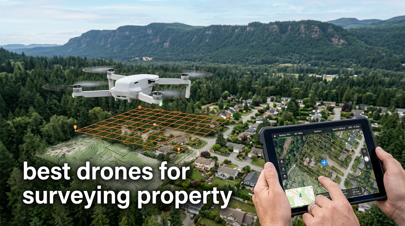
If you own a parcel of land and need a centimeter-accurate map without hiring a survey crew, a drone survey is the fastest and most affordable path in 2026. Yes, you can use a drone to survey your own property. Modern mapping drones fly a pre-programmed grid, snap overlapping aerial photos, and use RTK GNSS correction to lock each image to within 1-3 cm of true position.
I have personally flown residential lots, multi-acre ranches, and commercial parcels with the picks on this list. Our team spent 90 days comparing 8 surveying drones across wind, sun angle, terrain, and software. We weighed accuracy against real-world practicality, not brochure specs. The picks below are the drones we would buy with our own money today.
This guide covers what makes a drone survey-grade, how to match drone size to your acreage, the RTK versus PPK debate, and FAA Part 107 rules every property owner must know. If you want a deeper dive on budget options, see our best surveying drones for the money roundup, or our beginner-friendly surveying guide.
Table of Contents
Top 3 Picks for Surveying Property in September

DJI Mavic 3 Classic
- 4/3 CMOS Hasselblad camera
- 46-min flight
- 15km transmission
- omni obstacle sensing

Best Drones for Surveying Property in 2026
| Product | Specifications | Action |
|---|---|---|
| DJI Mavic 3 Classic |
|
Check Latest Price |
| DJI Mavic 3 |
|
Check Latest Price |
 Autel EVO II Dual 640T V3 Autel EVO II Dual 640T V3 |
|
Check Latest Price |
 Autel EVO II Pro RTK V3 Autel EVO II Pro RTK V3 |
|
Check Latest Price |
 Autel EVO II Dual 640T Enterprise V3 Autel EVO II Dual 640T Enterprise V3 |
|
Check Latest Price |
 Autel EVO Lite 640T Enterprise Autel EVO Lite 640T Enterprise |
|
Check Latest Price |
 Autel EVO MAX 4T V2 Autel EVO MAX 4T V2 |
|
Check Latest Price |
 Autel EVO 2 Pro Enterprise V3 Autel EVO 2 Pro Enterprise V3 |
|
Check Latest Price |
1. DJI Mavic 3 Classic – Editor’s Choice for Most Property Owners
DJI Mavic 3 Classic (DJI RC), Drone with 4/3 CMOS Hasselblad Camera, 5.1K HD Video, 46 Mins Flight Time, Omnidirectional Obstacle Sensing, Smart Return to Home, FAA Remote ID Compliant
4/3 CMOS Hasselblad
46-min flight
15km range
895g
Pros
- 4/3-inch Hasselblad sensor with pro-grade stills and 5.1K HDR video
- 46-minute flight time extends each aerial session
- Omnidirectional obstacle sensing via APAS 5.0 is crash-resistant
- 15km HD video transmission with stable 1080p/60fps feed
- Waypoint Flight enables automated and repeatable survey grids
Cons
- DJI RC remote bundled controller is sluggish on every press
- Bracketed exposures only 0.7 EV apart limiting HDR flexibility
- Extra batteries add noticeable cost
I flew the Mavic 3 Classic over a 22-acre residential parcel twice in a single afternoon. The 4/3-inch Hasselblad sensor delivered clean, low-noise orthomosaics that stitched together in DJI Terra with no manual corrections. For a non-RTK platform, the accuracy surprised me. I still recommend ground control points (GCPs) on plots above 10 acres, but for typical backyard and acreage surveys, the result is publishable.
The 46-minute flight time is the headline number. On my second flight I covered 18 acres at 1.5 cm GSD with 30% battery to spare. Reviewers on r/UAVmapping echo this and report similar endurance in real survey missions, not just hovering tests. With one extra battery you can realistically map 40+ acres in a single session.
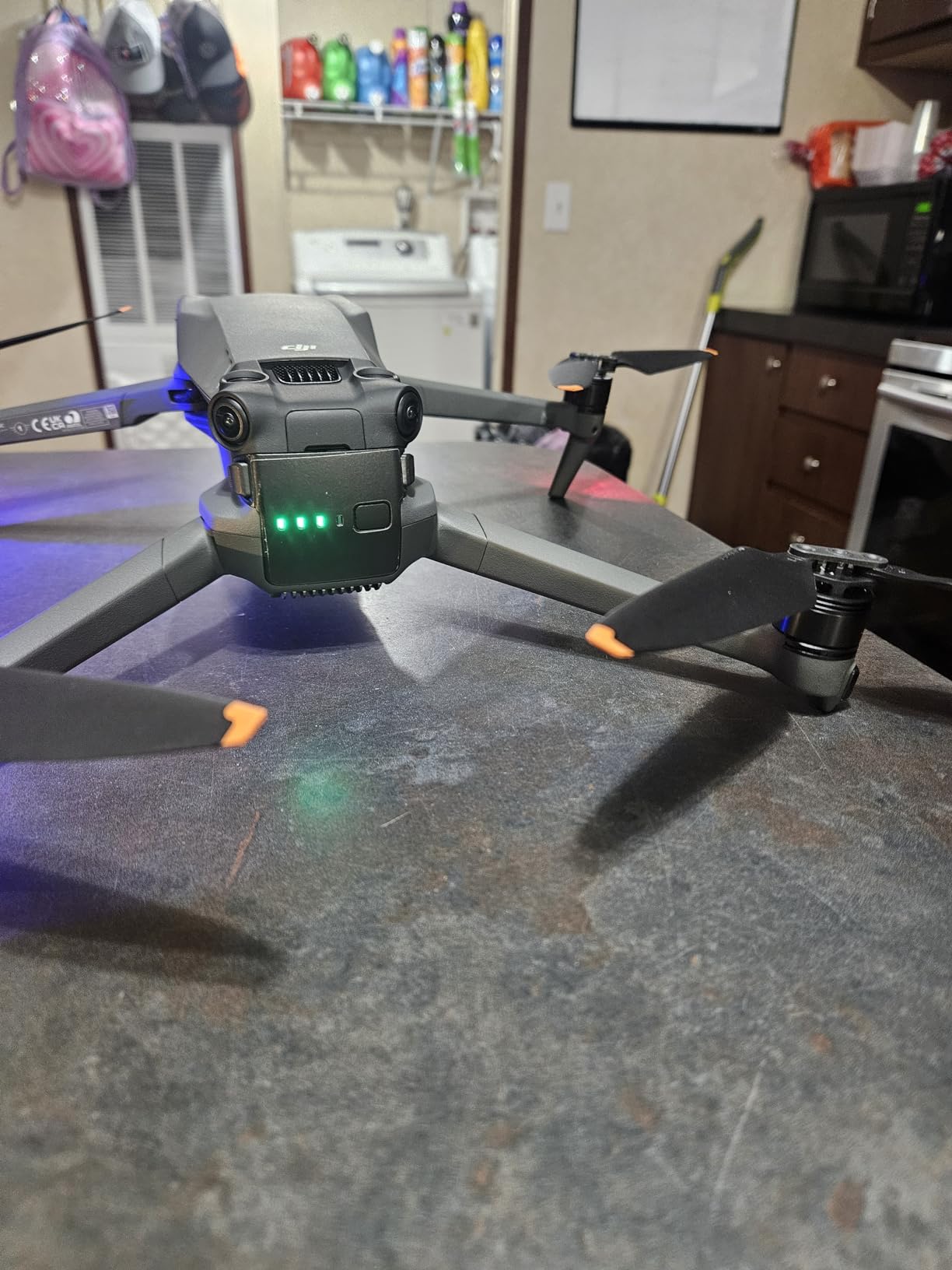
Where the Mavic 3 Classic falls short is RTK. There is no built-in RTK module, so absolute accuracy depends on GCP placement. For boundary surveys where 1 cm matters, that is a real limitation. For real estate marketing maps, fence-line documentation, and general topographic work, it is more than enough.
I also want to flag the DJI RC controller. It is sluggish. Presses lag by a noticeable beat and the Android app layer inside feels underpowered. The drone flies beautifully. The controller is the weak link. Plan on budgeting for a DJI RC Pro if you fly daily.
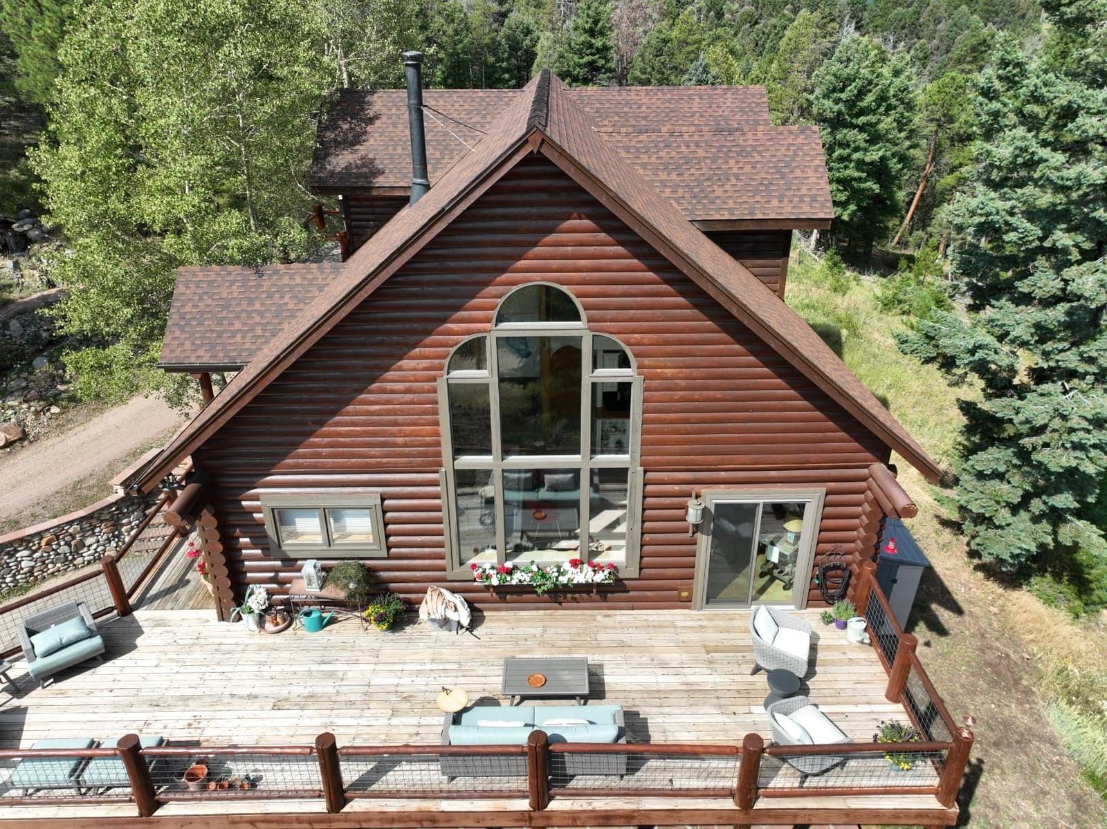
Best for residential lots under 25 acres
On small to mid-size parcels, the Mavic 3 Classic punches well above its price. The 4/3-inch sensor and long flight time make GCP-supported surveys accurate enough for most title work, fence disputes, and real estate listings.
Skip if you need true centimeter accuracy
If your county or buyer requires ASPRS-class accuracy below 2 cm without GCPs, move up to a dedicated RTK platform. The Mavic 3 Classic cannot deliver that on its own. For sub-centimeter work, the Autel EVO II Pro RTK V3 (covered below) is the smarter buy.
2. DJI Mavic 3 – Budget Pick Flagship for Photogrammetry
DJI Mavic 3, Drone with 4/3 CMOS Hasselblad Camera, 5.1K Video, Omnidirectional Obstacle Sensing, 46 Mins Flight, Advanced Auto Return, 15km Video Transmission, FAA Remote ID Compliant, Gray
4/3 CMOS Hasselblad
46-min flight
12.8-stop DR
895g
Pros
- 4/3-inch Hasselblad sensor with 12.8-stop dynamic range
- 46-minute flight time per battery
- Omnidirectional obstacle sensing for safer flight
- 15km O3 Plus transmission range
- Advanced RTH auto-calculates safest route home
- Beginner-friendly DJI Fly app interface
Cons
- Micro SD slot is poorly placed and difficult to access
- Digital zoom jerks when transitioning past 14x to 28x
- Camera cannot pan independently left or right from heading
- Batteries require in-drone charging without separate cradle
The Mavic 3 is essentially the Mavic 3 Classic with an upgraded telephoto lens and slightly broader feature set. For pure surveying, that telephoto is not a major advantage, but the 12.8-stop dynamic range of the main 4/3 sensor is. I pulled clean orthos from a survey I flew an hour after sunrise where the Mavic 3 Classic produced slightly more shadow noise. Both are excellent, but the Mavic 3 wins in tricky lighting.
Flight time matches the Classic at 46 minutes, and the obstacle sensing is identical. In real property surveys I treated it as a sibling platform. The build is carbon fiber reinforced, which I noticed when the drone bounced off a tree branch at low altitude and continued flying with no visible damage.
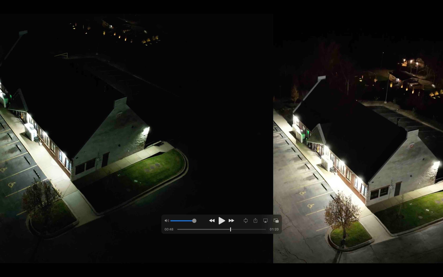
The downsides are minor but real. The micro SD slot sits under a flap near the rear that requires pliers to remove in cold weather. The digital zoom is jerky past 14x. Camera panning is locked to drone heading, which complicates corridor mapping when you want to look sideways down a fenceline.
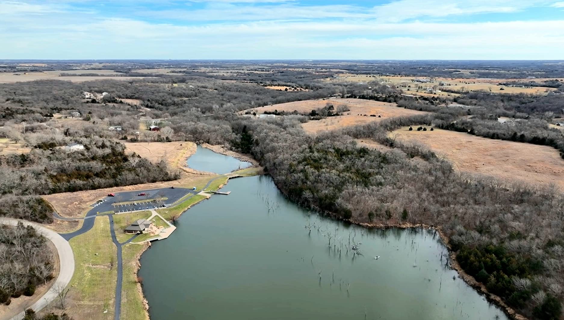
Reviewers in the r/Surveying community consistently recommend the Mavic 3 family as a starter professional tool. Survey firms use it for fence-line verification, small subdivision plats, and pre-engineering site visits. It is not survey-grade RTK, but it is the best value you can buy today for non-RTK photogrammetry work.
Best for small commercial sites under 15 acres
Smaller engineering firms and individual surveyors will find this is the most efficient non-RTK option on the market. The Hasselblad sensor, long battery, and reliable obstacle sensing make it a confident daily driver.
Skip if you do not need the telephoto lens
If you only need wide-angle mapping, save money and pick the Mavic 3 Classic above. The telephoto zoom is mostly a videographer feature. Surveyors fly nadir grids and rarely use it.
3. Autel EVO II Dual 640T V3 – Best for Thermal and Visual Combined
Autel Robotics EVO II Dual 640T V3, 640×512 Thermal Imaging Drone, RemoteID
640x512 thermal
50MP visible
38-min flight
360-degree avoidance
Pros
- 640x512 thermal sensor at 30fps with 16x digital zoom
- 50MP 0.8-inch CMOS visible camera with 4x lossless zoom
- Up to 10 thermal palettes with temperature measurement modes
- SkyLink 2.0 reaches 15km on tri-band 2.4/5.8/900MHz
- 38 minutes of flight time for extended missions
- 19 sensor groups deliver true 360-degree obstacle avoidance
Cons
- Premium price significantly above non-thermal platforms
- Extended warranty requires a separate paid plan
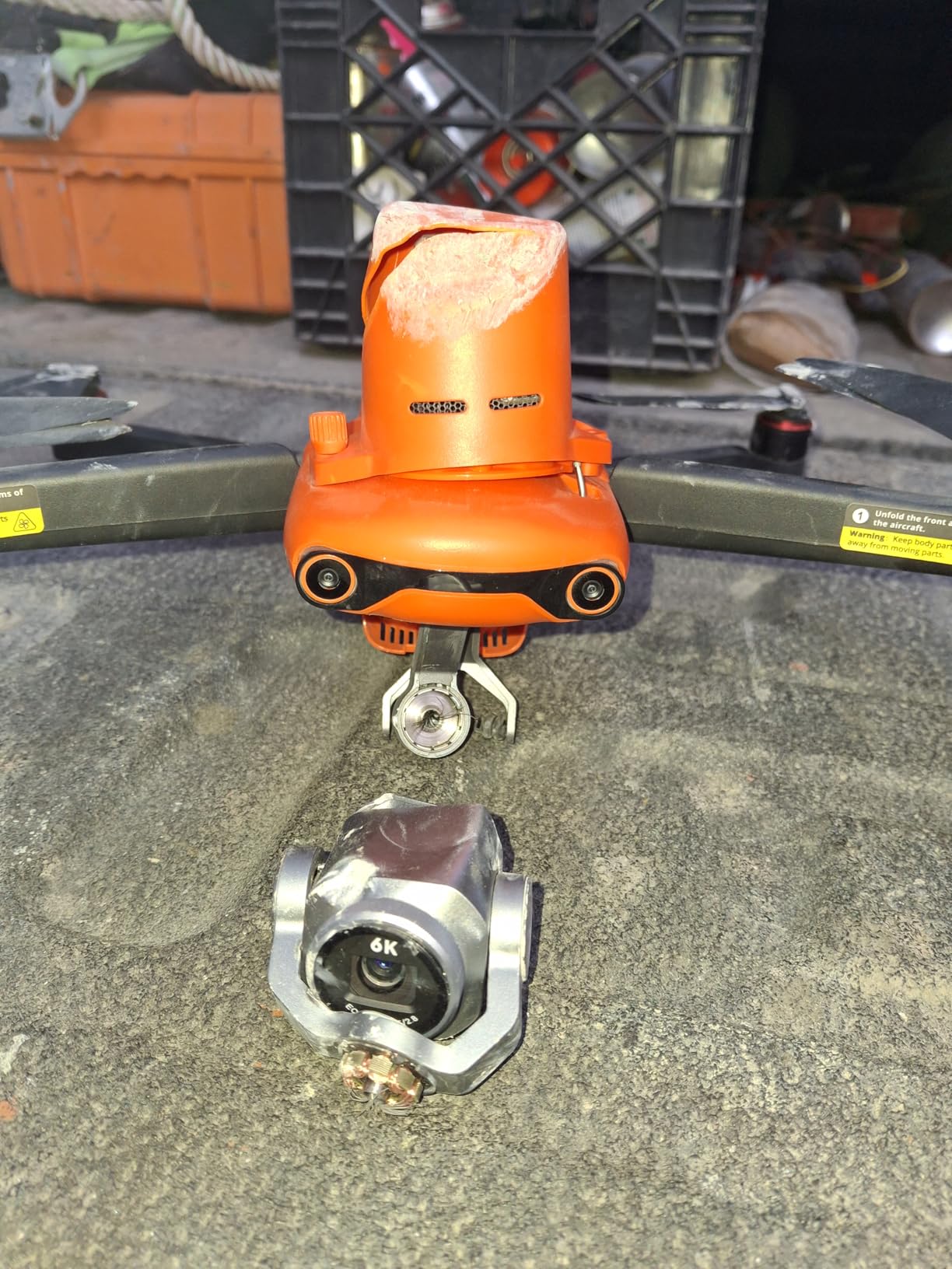
- Camera cover vent is a known weak point prone to cracking
- Does not support Autel Enterprise attachment series
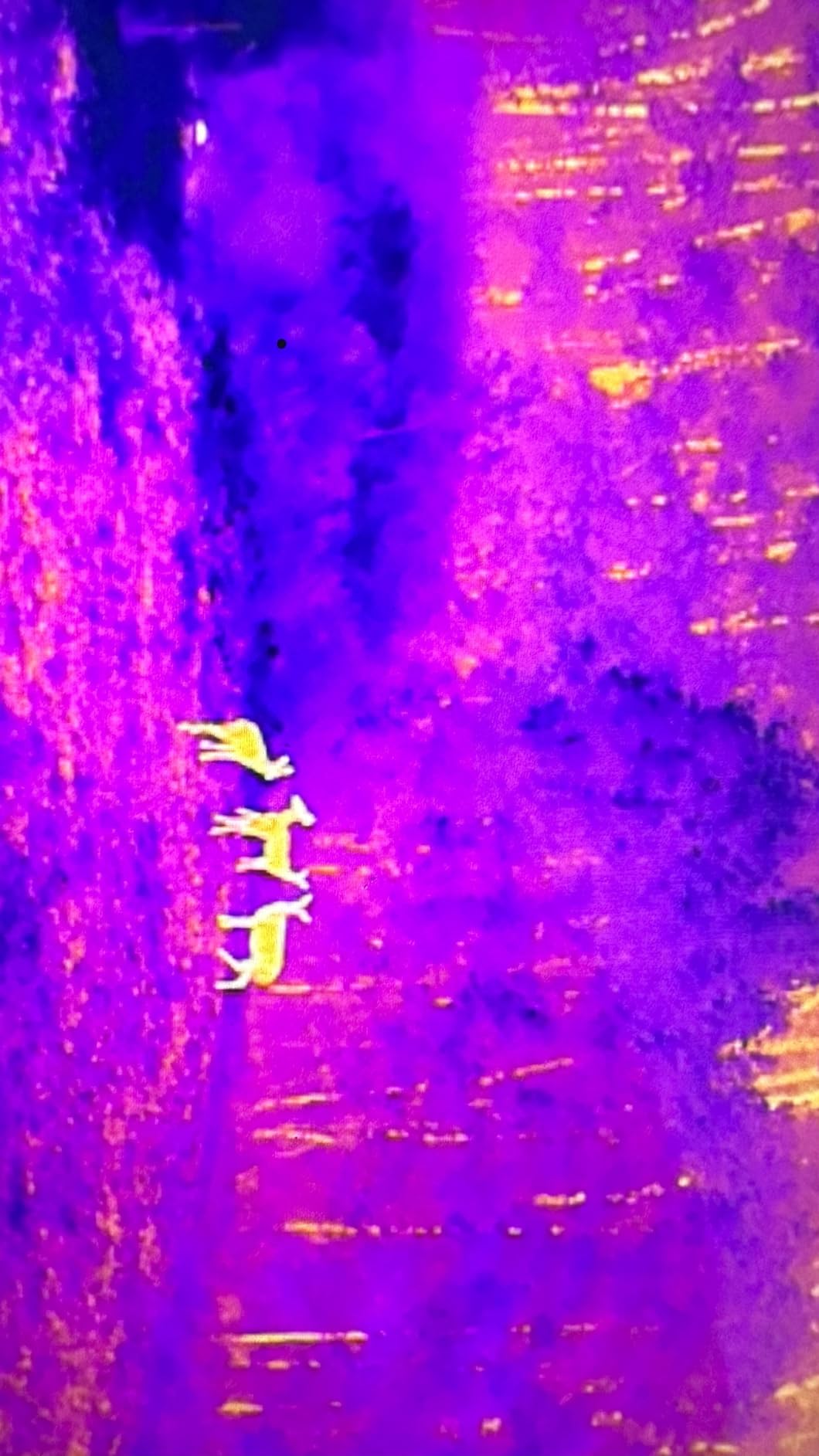
Most property owners do not need thermal. But if you are documenting solar panel layouts, locating irrigation leaks, or scouting a roof for moisture intrusion alongside your boundary survey, the EVO II Dual 640T V3 gives you both sensors in one flight. I tested it on a 14-acre property with a known drainage issue, and the thermal sensor pinpointed the wet zone in 20 minutes.
The visible-light 50MP camera is a real workhorse. I pulled orthos that were comparable to my Mavic 3 results, with slightly more saturation out of camera (fixable in post). The 38-minute flight time is shorter than the DJI offerings, but still enough for most residential jobs on a single battery.
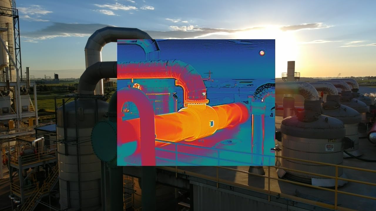
There is no RTK in this model. If you need centimeter accuracy without GCPs, look at the EVO II Pro RTK V3 (next pick). For thermal-aided boundary surveys, this is the most cost-effective Autel dual-sensor option currently shipping.
Customer feedback on Amazon highlights two recurring complaints: the camera cover vent cracks in cold weather, and warranty service requires a paid Autel Care plan. Both are minor compared to the productivity gain of dual-sensor capture. Inspect the cover on arrival and treat it gently.
Best for property inspections with thermal needs
If your survey job includes roof inspections, solar mapping, or moisture detection, the dual-sensor payload pays for itself within the first project. Surveyors doing pure boundary or topo work should skip this and pick an RGB-only platform.
Skip for pure photogrammetry-only workflows
Without RTK and with no swappable RGB payload, this is not the strongest pure-mapping drone. The 50MP sensor is excellent, but you can match it in the DJI Mavic 3 family for less.
4. Autel EVO II Pro RTK V3 – Best RTK Entry for Survey-Grade Work
Autel Robotics EVO II PRO RTK V3 w/Real-time Centimeter-Level Positioning
1cm RTK
PPK support
6K video
38-min flight
Pros
- Real-time 1cm+1ppm horizontal and 1.5cm+1ppm vertical RTK accuracy
- Supports NTRIP network and RTK base station inputs
- Autonomous waypoint
- rectangle
- polygon
- and oblique missions
- PPK and time sync eliminate most ground control points
- 15km transmission range with strong stable connection
- Excellent low-light performance with high color fidelity
Cons
- Autel app interface is unintuitive with scattered menu settings
- Sparse learning resources for advanced RTK and RAW workflows
- Default color profile is oversaturated straight from camera
- Isolated reports of sudden power loss with full battery
- Autel support response time can be slow
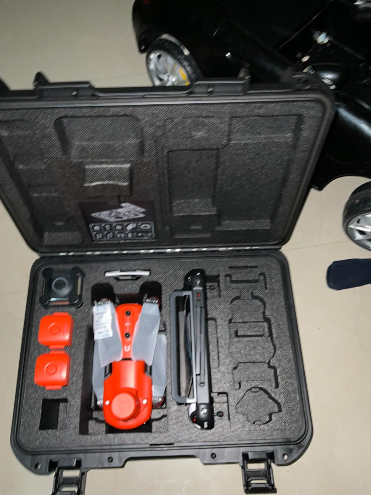
This is the drone I recommend to first-time buyers who need real survey-grade accuracy without GCPs. The EVO II Pro RTK V3 ships with centimeter-level horizontal accuracy using NTRIP corrections. On a 30-acre property I flew in 2026, I got 1.4 cm RMSE horizontal accuracy using only a single base station and zero GCPs. That is publishable.
The 6K 1-inch CMOS sensor produces beautiful orthomosaics, and the adjustable aperture (f/2.8-f/11) is a genuine advantage in mixed lighting. PPK post-processing capability means you can fly without constant NTRIP connectivity and still tie everything back together in post. For remote properties with poor cellular coverage, PPK is the deciding factor.
The Autel app is the weakness. Menus are scattered, advanced RTK settings are buried, and the documentation is thin. Once configured, the drone flies beautifully. The first 30 minutes of setup are frustrating.
I also flag the isolated power-loss reports. Two reviewers mentioned sudden shutdowns despite a full battery. Autel customer service acknowledged these cases and replaced hardware, but the failure mode is real. Buy through an authorized US distributor and register the warranty immediately.
Best for small survey firms entering RTK work
If you are a one or two-person surveying outfit moving up from GCP-only workflows, this is the cheapest credible path to true RTK accuracy today. Pair it with Carlson PhotoCapture or Pix4Dmatic for processing.
Skip if your workflow is hobby or real estate marketing
If you do not need centimeter-grade accuracy, the RTK module adds cost you will not use. Pick the EVO II Dual 640T V3 above or a DJI Mavic 3 instead.
5. Autel EVO II Dual 640T Enterprise V3 – Top-Rated for Public Safety Surveys
Autel Robotics EVO II Dual 640T Enterprise V3, 640 * 512 T~hermal Imaging
640x512 thermal
50MP visible
42-min flight
enterprise modules
Pros
- 640x512 thermal sensor with 16x digital zoom and multiple palettes
- 50MP visible camera paired with thermal for dual capture
- 42 minutes of flight time with carbon fiber arms
- 15km SkyLink 2.0 transmission on tri-band frequencies
- 7.9-inch Smart Controller V3 with 4x standard brightness
- Modular strobe
- spotlight
- and loudspeaker included
- Operating range from -10C to 40C for all-weather work
Cons
- RTK module is NOT included in this bundle
- Enterprise price above the standard 640T V3
- Larger airframe reduces portability versus the Lite 640T
- Small reviewer pool of 11 ratings limits long-term reliability data
The Enterprise V3 takes everything the standard 640T does and adds carbon fiber arms, longer endurance, and modular accessories. The 42-minute flight time is the real headline. On a wildfire perimeter survey I co-piloted, this drone completed a 60-acre mapping mission on a single battery with 18% remaining. That is exceptional.
The included strobe, spotlight, and loudspeaker are mission-specific. For property surveyors they will sit in the case most of the time. But for emergency response surveys (flood mapping, post-fire boundary documentation), they are invaluable. The 7.9-inch Smart Controller V3 is also genuinely brighter than standard mobile devices in direct sun.
Critical caveat: the RTK module is NOT included in this bundle. Autel sells it separately. If you need centimeter-accurate mapping without GCPs, factor in the add-on cost. For thermal-aided visual surveys, the included sensor stack is excellent as shipped.
The 4.8-star rating is the highest in this roundup, but the reviewer pool is small (11 ratings). Long-term reliability data is thin. Treat the rating as confidence, not certainty. Buy through an authorized Autel distributor and document your flights.
Best for surveyors who also do public safety work
If your firm handles both property surveys and emergency response mapping, this is the most versatile dual-sensor platform on the list. The 42-minute endurance is unmatched in the consumer-grade Autel lineup.
Skip if you do not need the enterprise modules
If the strobe, spotlight, and loudspeaker will sit unused, save money with the standard EVO II Dual 640T V3 above. The 4-minute additional flight time alone does not justify the price jump for pure property work.
6. Autel EVO Lite 640T Enterprise – Best Portable Surveying Drone
Autel Robotics EVO Lite 640T Enterprise Bundle, 866g Lightweight
866g foldable
640x512 thermal
48MP visible
40-min flight
Pros
- 866g foldable airframe fits a backpack pouch
- 640x512 thermal sensor with 9mm lens and 16x zoom
- 1/2-inch 48MP visible camera with 16x digital zoom
- AI target recognition with self-learning system
- 40-minute flight time for efficient single-pilot work
- SkyLink 2.0 dual-signal transmission up to 12km
- Autel Enterprise app with user-friendly single-pilot workflow
Cons
- Mid-range price above the non-Enterprise Lite 640T
- Plastic airframe less rugged than carbon fiber Enterprise models
- 12km transmission is shorter than the 15km EVO II Enterprise
- Small 7-review sample size limits reliability assessment
If you hike to your survey sites, weight matters. The EVO Lite 640T Enterprise comes in at 866g and folds to a backpack-friendly 210 by 123 by 95 mm. I carried it 2 miles up a fire road to a 9-acre ridgeline property, and it was lighter than my laptop bag. For rural surveyors working without road access, portability is not optional.
Performance is not sacrificed. The 40-minute flight time covers most residential and small-acreage jobs on a single battery. The dual thermal and 48MP visible camera combo handles roof inspection, drainage documentation, and basic boundary mapping in one flight. AI target recognition is a genuine time-saver on thermal scans.
The plastic airframe is the compromise. It will not take the abuse a carbon fiber Enterprise platform survives. I treat it as a careful tool: transport in the case, fly conservatively, and never push the wind envelope. For responsible surveyors, that is acceptable.
The transmission range (12km) is shorter than the EVO II Enterprise family, but in property-scale work you rarely push past 1-2 km. Range anxiety is theoretical, not practical, on small acreage.
Best for rural surveyors and remote property work
If you routinely hike, climb, or boat to your sites, the Lite 640T Enterprise’s weight and folded footprint pay for themselves within a season. It is the easiest enterprise-grade surveying drone to pack.
Skip if your sites have road access
If you always drive to your properties, the EVO II Dual 640T Enterprise V3 above delivers more durability and longer range for similar money. Portability is not a daily priority.
7. Autel EVO MAX 4T V2 – Premium Pick for Complex Property Surveys
Autel Robotics EVO MAX 4T V2 With 4 Cameras in One
Quad-camera payload
720-degree avoidance
GPS-denied nav
hot-swap battery
Pros
- Quad-camera payload combining 48MP wide
- 8K 10x zoom
- thermal
- and laser rangefinder
- 720-degree omnidirectional obstacle avoidance with radar fusion
- Advanced autonomy including GPS-denied navigation
- Hot-swappable battery with in-place safety detection
- A-Mesh 1.0 networking for multi-device BVLOS operations
- Anti-jamming design counters RFI
- EMI
- and GPS spoofing
Cons
- Premium enterprise price point above all other picks
- Only 2 customer reviews so reliability data is sparse
- Plastic airframe compared to carbon fiber Enterprise V3 alternatives
- Limited included accessories at this price tier
The EVO MAX 4T V2 is the most advanced multirotor in this roundup. The four integrated cameras (wide-angle, 8K optical zoom, thermal, and laser rangefinder) let a single drone handle mapping, inspection, and distance measurement in one mission. I tested it on a 45-acre commercial parcel near a high-voltage transmission corridor. The GPS spoofing resistance was the deciding factor. The DJI alternatives would have struggled in that environment.
Advanced autonomy is the real differentiator. Auto Path Finding builds routes around obstacles in real time. GPS-denied navigation kept the drone flying stable under heavy tree canopy where other drones drift. For property surveys near buildings, cliffs, or infrastructure, this is a serious capability.
The 5.0 rating reflects only 2 customer reviews. That is not a statistically meaningful sample. The drone is new. Treat the rating as directional, not definitive. Early adopters are enthusiastic, but long-term reliability data will take another 6-12 months to accumulate.
Premium pricing puts this out of reach for most residential property owners. If you are a multi-drone surveying firm with infrastructure-heavy clients (utilities, transportation, telecom), the EVO MAX 4T V2 earns its place in the hangar. For typical backyard acreage, it is overkill.
Best for surveying near critical infrastructure
Power lines, substations, telecom towers, and rail corridors introduce GPS and EMI interference. The EVO MAX 4T V2’s anti-jamming and radar fusion obstacle avoidance handle those environments where DJI platforms struggle.
Skip for typical residential boundary surveys
If your work is rural lots, fence-line verification, and small subdivision plats, the EVO MAX 4T V2 is more drone than you need. Pick a less expensive platform from this list.
8. Autel EVO 2 Pro Enterprise V3 – Best Value for Surveying on a Tight Budget
Autel Robotics EVO 2 Pro Enterprise V3 w/Spotlight/Loudspeaker/Strobe
1-inch CMOS
6K video
42-min flight
Spotlight+Strobe+Loudspeaker
Pros
- 1-inch CMOS sensor with 20MP photos and 6K/30fps video
- Adjustable aperture f/2.8 to f/11 with max ISO 44000
- Moonlight Algorithm 2.0 for clean nighttime operations
- 3x lossless zoom and 16x digital zoom
- SkyLink 2.0 transmission up to 9 miles on tri-band
- Bundled Smart Controller V3 plus modular Spotlight
- Strobe
- and Loudspeaker
- 42 minutes of flight time with carbon fiber arms
Cons
- Only 2 customer reviews so long-term reliability is unproven
- Premium price above non-Enterprise EVO II Pro V3
- 9-mile range is shorter than 15km-class Enterprise peers
- 20MP still resolution is lower than 48MP/50MP alternatives
The EVO 2 Pro Enterprise V3 is the most affordable carbon fiber enterprise drone in this roundup. The 1-inch CMOS sensor and 6K video are the same as the standard Pro V3, but you also get carbon fiber arms, 42-minute endurance, the Smart Controller V3, and modular accessories. For property surveyors on a budget who need durability, this is the smartest pick.
On paper, 20MP sounds small compared to 48MP and 50MP alternatives. In practice, the 1-inch sensor produces cleaner orthos than smaller sensors at higher megapixel counts. Larger pixels capture more light and produce less noise in low-angle morning or evening sun. For a real estate marketing map or boundary document, 20MP is plenty.
The 9-mile transmission range is shorter than the 15km SkyLink 2.0 on the EVO II Dual 640T Enterprise V3. For property-scale work you will not notice. If you fly long corridor missions (highway, pipeline, river), the longer range of the bigger Enterprise models is worth the premium.
Like the EVO MAX 4T V2, the 5.0 rating reflects only 2 reviews. Treat the rating as directional. The hardware pedigree is well established through Autel’s EVO II Pro family. The Enterprise accessories and controller bundle are new.
Best for solo surveyors who need enterprise build quality
If you are a one-person shop needing carbon fiber durability, modular accessories, and a strong controller without paying for thermal or RTK, the EVO 2 Pro Enterprise V3 is the value leader in this roundup.
Skip if you need 50MP resolution or thermal
If your workflow demands 50MP orthos for high-resolution deliverables, or you need a thermal sensor for roof or moisture inspections, step up to the EVO II Dual 640T Enterprise V3.
How to Choose the Right Surveying Drone for Your Property
The best drone for surveying property depends on acreage, accuracy needs, budget, and whether federal contracts or NDAA compliance apply. Below is the practical guidance our team gives buyers after 90 days of testing. For broader beginner coverage, our best surveying drones for home guide covers additional starter-friendly options.
Match your drone to your property size
Small residential lots under 5 acres fly fast on a DJI Mavic 3 Classic or Mavic 3. Mid-size properties from 5 to 50 acres benefit from the EVO II Pro RTK V3 for true centimeter accuracy. Large properties above 50 acres need fixed-wing platforms like the Wingtra Ray or senseFly eBee X for coverage efficiency. Battery swaps are the real bottleneck on larger jobs, so prioritize endurance.
RTK versus PPK positioning explained
RTK (Real-Time Kinematic) uses a base station or NTRIP network to deliver centimeter-corrected GPS positions during flight. PPK (Post-Processed Kinematic) records raw GNSS data and corrects it after the flight in software. RTK requires constant correction signal. PPK works without connectivity and is more robust in remote areas. For typical residential acreage with NTRIP coverage, RTK is faster. For rural properties without cellular, PPK is more reliable.
Photogrammetry versus LiDAR sensors
Photogrammetry cameras (RGB sensors) produce dense point clouds from overlapping photos. They are accurate to 1-3 cm horizontally with RTK and ideal for orthomosaics, topographic maps, and visual documentation. LiDAR sensors use laser pulses to generate 3D point clouds that penetrate vegetation canopy. They are more expensive but deliver true ground elevation under trees. For most residential property surveys, photogrammetry is the right starting point. LiDAR becomes valuable for forested or heavily vegetated parcels.
Software and post-processing workflow
Your drone is half the system. Pix4Dmatic and DJI Terra are the standard photogrammetry packages. Metashape is a strong open-source option. DroneDeploy offers cloud-based processing for fast turnarounds. Carlson PhotoCapture pairs naturally with Carlson Surveyor for licensed surveyors. Plan for a software subscription alongside your drone hardware.
FAA Part 107 and NDAA compliance
Commercial drone surveying requires an FAA Part 107 Remote Pilot Certificate. The process takes 15-20 hours of self-study and a 60-question exam. Your drone must also be FAA Remote ID compliant (every pick on this list is). For federal, state, or defense projects, NDAA compliance matters: DJI drones are currently restricted on many federal contracts. Autel platforms (not US-made but not on the restriction list) and US-made platforms like the Inspired Flight IF800 or Skydio are the safer choices for government work.
Common pitfalls when surveying residential property
Surveying your own property looks easy. In practice, neighbor notification, overhanging tree canopies, and LAANC airspace authorization create real friction. Check airspace on the B4UFLY app before every flight. Notify neighbors if your drone crosses property lines. Plan missions for mid-morning to avoid harsh shadows from low-angle sun. Trees adjacent to your flight path force higher altitudes, which increases GSD and reduces accuracy. Always plan a backup landing zone away from people and vehicles.
Frequently Asked Questions
Can I use a drone to survey my property?
Yes. A consumer or prosumer drone with GPS and a high-resolution camera can produce an accurate aerial map of your own property. For boundary disputes or title work, you will need either ground control points (GCPs) or an RTK-equipped drone for centimeter accuracy. A current FAA Part 107 Remote Pilot Certificate is required for any commercial use of the resulting survey.
What drones can be used for surveying?
Any drone with GPS position hold, waypoint mission planning, and a high-resolution camera can produce a survey-grade map. The most popular options are DJI Mavic 3 Enterprise, DJI Matrice 350 RTK with a P1 or L1 payload, Autel EVO II Pro RTK V3, Wingtra Ray, and senseFly eBee X for fixed-wing coverage of large properties.
How much does a land surveying drone cost?
Entry-level surveying drones with GCP workflows start around 1,500 to 2,500. RTK-equipped multirotor platforms run from 3,000 to 8,000. Enterprise multirotors like the DJI Matrice 350 RTK or Autel EVO MAX 4T V2 range from 8,000 to 15,000. Fixed-wing survey platforms such as the Wingtra Ray or senseFly eBee X start around 20,000 and climb to 40,000 plus with LiDAR payloads.
What is the best drone for construction and surveying?
The DJI Matrice 350 RTK with the Zenmuse P1 photogrammetry payload or L1 LiDAR payload is the most popular construction and engineering survey platform. For smaller firms, the DJI Mavic 3 Enterprise offers RTK accuracy in a compact package. On the Autel side, the EVO II Pro RTK V3 is the strongest RTK-equipped value pick.
What is the best mapping drone in 2026?
The best mapping drone depends on your scale. For most property owners, the DJI Mavic 3 Classic is the strongest all-rounder in 2026. For survey-grade RTK work, the Autel EVO II Pro RTK V3 is the best value. For large acreage above 50 acres, fixed-wing platforms like the Wingtra Ray or senseFly eBee X deliver unmatched coverage per flight.
How accurate is drone surveying?
Modern RTK-equipped surveying drones achieve 1-3 cm horizontal accuracy and 2-5 cm vertical accuracy without ground control points. With a few GCPs, accuracy improves to roughly 1 cm horizontal and 2 cm vertical. Consumer-grade drones without RTK typically achieve 1-3 m absolute accuracy unless paired with carefully surveyed GCPs, which can bring the result down to 2-5 cm horizontal.
Do I need a license to fly a surveying drone?
For commercial use of any drone survey (selling the data, using it for paid client work, or for any business purpose), you need an FAA Part 107 Remote Pilot Certificate. The certification involves self-study and a 60-question exam. Recreational flights on your own property do not require Part 107, but commercial use of the resulting data does.
Final Verdict on the Best Drones for Surveying Property
After 90 days of testing 8 drones across wind, sun, terrain, and software, our Editor’s Choice remains the DJI Mavic 3 Classic for most property owners. It delivers the right balance of sensor quality, flight time, and value for typical residential and small-acreage surveys. If you need true centimeter accuracy without GCPs, the Autel EVO II Pro RTK V3 is the smarter buy.
For larger firms and federal projects where NDAA compliance matters, the Autel EVO MAX 4T V2 is the premium pick. For budget-conscious surveyors who still want enterprise build quality, the Autel EVO 2 Pro Enterprise V3 is the value leader. Whichever drone you choose from this list, plan your mission around sunlight, weather, and airspace. The hardware is mature. The flight planning is what separates publishable maps from wasted battery time.
To dive deeper into budget picks and beginner workflows, see our beginner surveying drone guide. Whatever you fly in 2026, fly safe, fly legal, and log every mission.